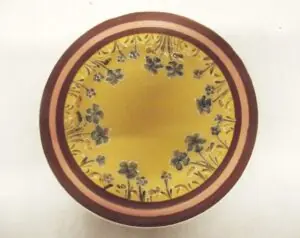
*British, WW2, RAF / MI9 Silk Escape & Evasion Map Scarf, French Indo-China & Siam (Thailand), Sheets 44J & 44K, Double-Sided*
A scarce and historically important Second World War British Royal Air Force silk escape and evasion map, produced for Allied aircrew operating over Japanese-held territory in the Far East.
This example is identified as Sheet 44J, covering Central French Indo-China (modern Vietnam, Laos, and Cambodia) together with Eastern Siam (Thailand), and forms part of a wider sectional mapping system used across Southeast Asia. The map is double-sided, with the reverse corresponding to Sheet 44K, depicting Southern French Indo-China and adjoining regions, including coastal and delta areas.
Printed at a scale of 1:1,000,000, the map provides detailed and practical navigational information, including rivers, road networks, settlements, railways, and terrain features, with contour shading and elevation references (“Heights in Metres”). The inclusion of an index panel showing adjacent sheets (44/C, 44/D, 44/K etc.) confirms its role within a coordinated escape and evasion mapping programme designed for operational use.
The map is printed on silk (or rayon) rather than paper, a deliberate choice reflecting its intended use in the field. Silk offered significant advantages: it is lightweight, compact, durable, water-resistant, and crucially silent when handled. These maps could be folded into very small packets, concealed within uniforms, sewn into linings, or carried as part of standard escape kits. In some cases, they were worn openly as scarves to avoid suspicion.
The use of period geographical terminology, including “French Indo China” and “Siam (Thailand)”, reflects wartime conventions prior to post-war political changes in the region.
Approx. Measurements – 93.5 cm x 63 cm.
History Note:
Escape and evasion maps of this type were developed and issued under the direction of MI9, the British military intelligence department responsible for aiding Allied personnel to evade capture. Distributed through RAF and Allied intelligence channels, such maps were issued to aircrew prior to operations over hostile or occupied territory, particularly in demanding theatres such as the China–Burma–India (CBI) theatre.
In the Far East, where dense jungle, limited infrastructure, and vast distances made survival and navigation especially difficult, these maps were a critical component of an airman’s escape kit. They were often carried alongside compasses, local currency, and phrase guides, enabling downed personnel to orient themselves and attempt escape or contact with friendly forces.
Compared to their European counterparts, Far East silk maps are encountered less frequently, reflecting both smaller production numbers and harsher conditions affecting survival rates of issued examples.
Following the war, due in part to material shortages, a number of these silk maps were repurposed into garments such as scarves or dresses, contributing to the relative scarcity of surviving examples in original form.
*Condition*
The map remains complete and structurally sound, with clear printed detail visible across both sides. There is evident age-related wear, including creasing from folding, areas of light staining and discolouration, and some surface soiling consistent with age and handling. The silk remains supple and intact, with no major losses observed, and the piece displays well overall. Please see photographs as part of the condition report.
JAQDEXIO_293227032026